
A Simple Guide to Melanesia’s Physical Geography
Melanesia is one of the three main regions of the Pacific Ocean, along with Polynesia and Micronesia. It stretches across the southwest Pacific and includes over 2,000 islands with a total land area close to 948,000 square kilometers—about the size of Ethiopia.
The region begins with the large island of New Guinea in the west and extends to Fiji in the east, covering about 5,600 kilometers (3,500 miles). It is surrounded by the Arafura Sea to the west, Australia and the Coral Sea to the south, Micronesia to the north (across the equator), and Polynesia to the east, marked by a line of volcanic activity known as the Andesite Line.
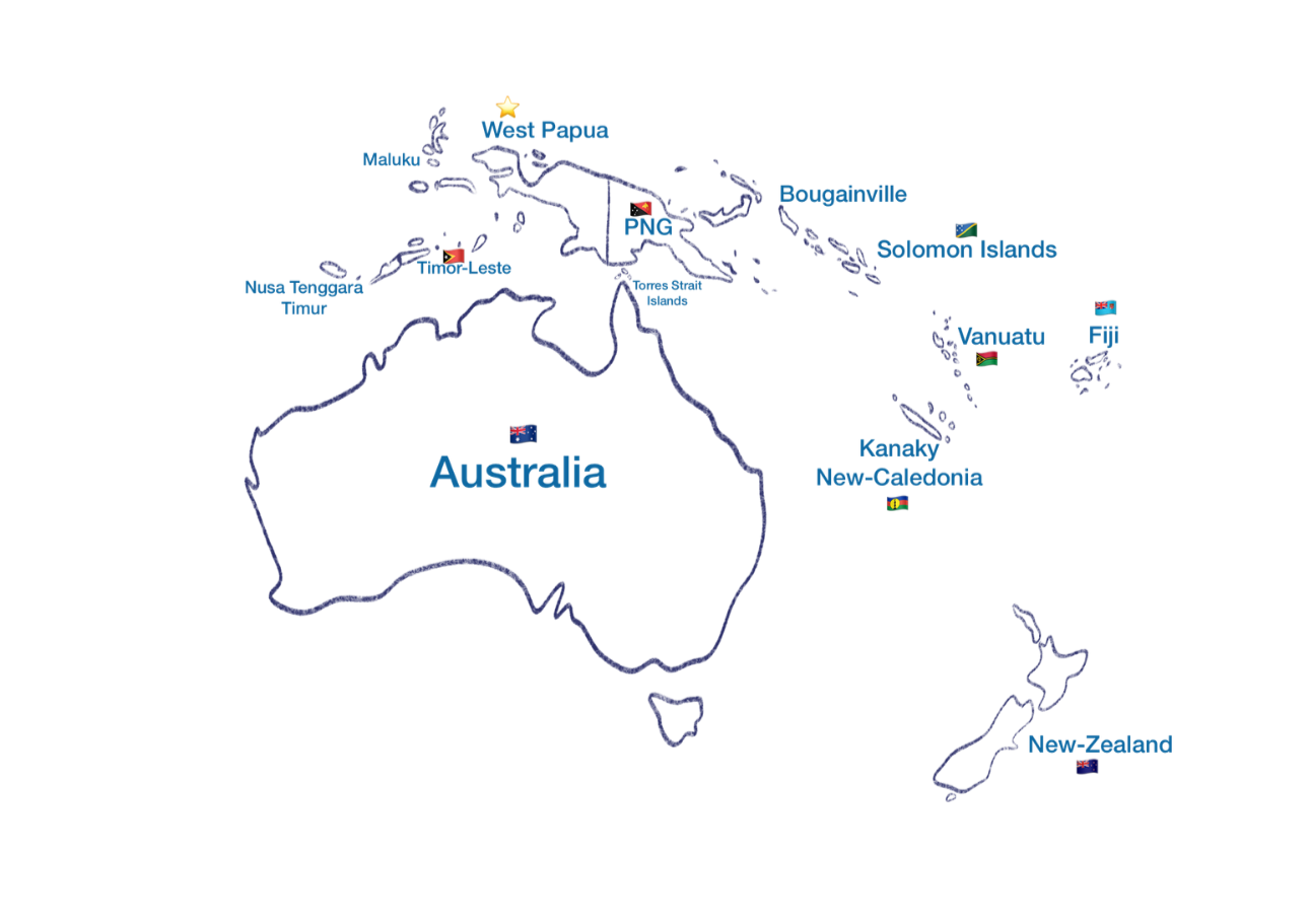
Melanesia is made up of several countries and territories:
Papua New Guinea, Solomon Islands, Vanuatu, and Fiji are independent nations.
West Papua (under Indonesian rule) and Kanaky-New Caledonia (a French territory) are still fighting for independence.
Melanesians were also the first inhabitants of Timor-Leste, Maluku, and Nusa Tenggara Timur before mixing with Austronesian settlers.
Timor-Leste is often considered part of Melanesia because its population and culture are heavily influenced by Melanesian and Papuan origins.
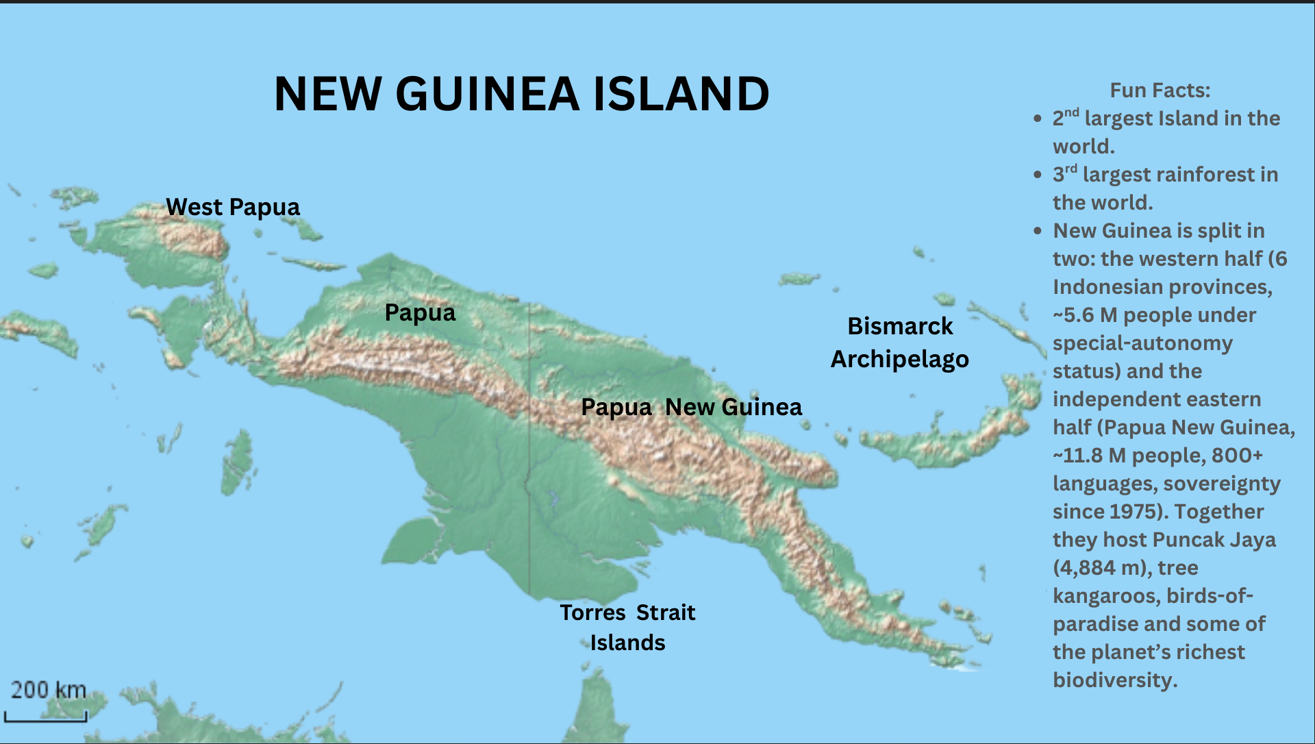
These islands vary widely in geography from high mountains and rainforests to coral atolls and active volcanoes. Today, the island of New Guinea is divided into two distinct regions with very different political realities. The western half, comprising the provinces of Papua and West Papua, is under Indonesian rule, where Indigenous Papuans have long sought self-determination amid reports of human rights violations, cultural suppression, and resource exploitation. In contrast, the eastern half forms the independent state of Papua New Guinea, which gained full sovereignty in 1975 and is home to over 800 Indigenous languages, vibrant cultural diversity, and a democratic government rooted in Melanesian traditions.
Timor-Leste (East Timor), although geographically part of Southeast Asia, is increasingly seen as part of Melanesia due to its cultural and ancestral ties. It is an observer in the Melanesian Spearhead Group and shares historical and linguistic roots with Melanesian peoples.
All of Melanesia lies along the Pacific Ring of Fire, making it prone to earthquakes, volcanic eruptions, and tsunamis. Despite these challenges, Melanesia is home to rich biodiversity, vibrant cultures, and hundreds of Indigenous languages, making it one of the most diverse regions in the world.
The Indigenous Peoples of the Pacific Islands
MELANESIA: Papua New Guinea, Vanuatu, Fiji, Solomon Islands, West Papua, Kanaky-New Caledonia, Torres Strait, Timor-Leste, the Maluku Islands, and Nusa Tenggara Timur (Eastern Lesser Sunda Islands).
MICRONESIA: Federated States of Micronesia [Yap, Chuuk, Pohnpei, and Kosrae], Palau, Guam, Northern Mariana Islands, Nauru, Kiribati, and the Marshall Islands.
POLYNESIA: Tonga, Samoa, American Samoa, Cook Islands, Easter Island, French Polynesia, Hawaii, New Zealand, Niue, Pitcarin Islands, and Tokelau, Tuvalu